 vesseltracker.com
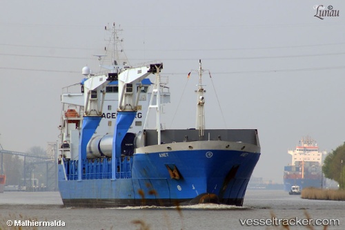
Vessel Anet IMO: 9456733, MMSI: 245020000 Multi Purpose Carrier
UTC, 43.33887, -13.28716, course: 233, speed: 12.1
UTC, 43.03833, -13.84666, course: -1, speed: 12
2026-01-31 15:45:22 UTC, 42.85167, -14.16500, course: -1, speed: 12
Live AIS position:
UTC. 142 nm NW of Bear River City),
updated 2026-01-31 15:45:22 UTC.
Find the position of the vessel Anet on the map. The latter are known coordinates and path.
marine traffic ship tracker show on live map
The current position of vessel Anet is 42.85167 lat / -14.16500 lng. Updated: 2026-01-31 15:45:22 UTCDetails:
Last coordinates of the vessel:
UTC, 43.57667, -12.82333, course: -1, speed: 12UTC, 43.33887, -13.28716, course: 233, speed: 12.1
UTC, 43.03833, -13.84666, course: -1, speed: 12
2026-01-31 15:45:22 UTC, 42.85167, -14.16500, course: -1, speed: 12