 vesseltracker.com
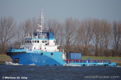
Vessel Dutch Blue IMO: 9646778, MMSI: 245081000 Offshore Tug Supply Ship
UTC, 40.62957, -74.06904, course: -1, speed: 0
UTC, 40.62956, -74.06899, course: -1, speed: 0
2026-01-16 23:21:58 UTC, 40.62953, -74.06906, course: -1, speed: 0
Live AIS position:
UTC. Near Tompkinsville),
updated 2026-01-16 23:21:58 UTC.
Find the position of the vessel Dutch Blue on the map. The latter are known coordinates and path.
marine traffic ship tracker show on live map
The current position of vessel Dutch Blue is 40.62953 lat / -74.06906 lng. Updated: 2026-01-16 23:21:58 UTCDetails:
Last coordinates of the vessel:
UTC, 40.62956, -74.06905, course: -1, speed: 0.1UTC, 40.62957, -74.06904, course: -1, speed: 0
UTC, 40.62956, -74.06899, course: -1, speed: 0
2026-01-16 23:21:58 UTC, 40.62953, -74.06906, course: -1, speed: 0