 vesseltracker.com
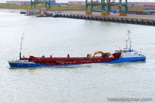
Vessel Ruyter IMO: 9085467, MMSI: 245231000 Hopper Dredger
UTC, 51.44099, 3.59889, course: -1, speed: 0
UTC, 51.44100, 3.59889, course: 121, speed: 0
2026-03-04 05:44:42 UTC, 51.44118, 3.59840, course: -1, speed: 0.3
Live AIS position:
UTC. Near Flushing),
updated 2026-03-04 05:44:42 UTC.
Find the position of the vessel Ruyter on the map. The latter are known coordinates and path.
marine traffic ship tracker show on live map
The current position of vessel Ruyter is 51.44118 lat / 3.59840 lng. Updated: 2026-03-04 05:44:42 UTCCurrently sailing under the flag of Netherlands
Ruyter built in 1994 year
Deadweight:
2800 tDetails:
Last coordinates of the vessel:
UTC, 51.44100, 3.59891, course: 122, speed: 0UTC, 51.44099, 3.59889, course: -1, speed: 0
UTC, 51.44100, 3.59889, course: 121, speed: 0
2026-03-04 05:44:42 UTC, 51.44118, 3.59840, course: -1, speed: 0.3