 vesseltracker.com
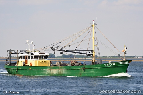
Vessel Ye 70 Maria Jacoba IMO: 8205577, MMSI: 245378000 Fishing Vessel
UTC, 53.04906, 4.97868, course: 265, speed: 0.7
UTC, 53.04933, 4.98036, course: 73, speed: 0
2026-03-03 12:19:50 UTC, 53.08402, 5.31371, course: 88, speed: 7.1
Live AIS position:
UTC. Near Kornwerderzand),
updated 2026-03-03 12:19:50 UTC.
Find the position of the vessel Ye 70 Maria Jacoba on the map. The latter are known coordinates and path.
marine traffic ship tracker show on live map
The current position of vessel Ye 70 Maria Jacoba is 53.08402 lat / 5.31371 lng. Updated: 2026-03-03 12:19:50 UTCCurrently sailing under the flag of Netherlands
Details:
Last coordinates of the vessel:
UTC, 53.04709, 5.03883, course: 280, speed: 8.7UTC, 53.04906, 4.97868, course: 265, speed: 0.7
UTC, 53.04933, 4.98036, course: 73, speed: 0
2026-03-03 12:19:50 UTC, 53.08402, 5.31371, course: 88, speed: 7.1