 vesseltracker.com
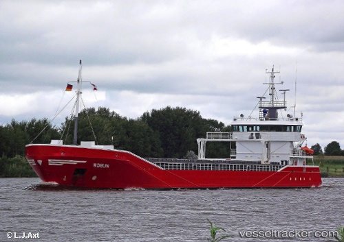
Vessel Robijn IMO: 9423669, MMSI: 245909000 General Cargo Ship
UTC, 51.46251, 3.69045, course: 239, speed: 0
UTC, 51.46248, 3.69048, course: 239, speed: 0
2026-03-11 15:50:13 UTC, 51.43619, 3.59162, course: 260, speed: 8.4
Live Vessel Robijn Analytics (details, animations, etc.)
Live AIS position: UTC. Near Flushing), updated 2026-03-11 15:50:13 UTC.Find the position of the vessel Robijn on the map. The latter are known coordinates and path.
marine traffic ship tracker show on live map
The current position of vessel Robijn is 51.43619 lat / 3.59162 lng. Updated: 2026-03-11 15:50:13 UTCDetails:
Last coordinates of the vessel:
UTC, 51.46252, 3.69046, course: 239, speed: 0UTC, 51.46251, 3.69045, course: 239, speed: 0
UTC, 51.46248, 3.69048, course: 239, speed: 0
2026-03-11 15:50:13 UTC, 51.43619, 3.59162, course: 260, speed: 8.4