 vesseltracker.com
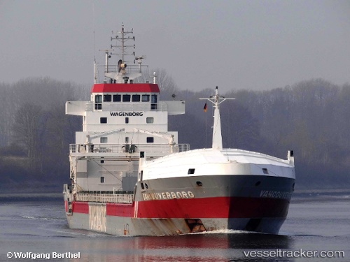
Vessel Vancouverborg IMO: 9213741, MMSI: 245930000 General Cargo Ship
UTC, 59.11050, 9.63283, course: -1, speed: 0.1
UTC, 59.11033, 9.63250, course: -1, speed: 0
2026-03-09 13:29:08 UTC, 59.11033, 9.63233, course: -1, speed: 0
Live Vessel Vancouverborg Analytics (details, animations, etc.)
Live AIS position: UTC. Near Herøya), updated 2026-03-09 13:29:08 UTC.Find the position of the vessel Vancouverborg on the map. The latter are known coordinates and path.
marine traffic ship tracker show on live map
The current position of vessel Vancouverborg is 59.11033 lat / 9.63233 lng. Updated: 2026-03-09 13:29:08 UTCCurrently sailing under the flag of Netherlands
Vancouverborg built in 2001 year
Deadweight:
9850 tDetails:
Last coordinates of the vessel:
UTC, 59.11033, 9.63267, course: -1, speed: 0.1UTC, 59.11050, 9.63283, course: -1, speed: 0.1
UTC, 59.11033, 9.63250, course: -1, speed: 0
2026-03-09 13:29:08 UTC, 59.11033, 9.63233, course: -1, speed: 0