 vesseltracker.com
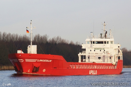
Vessel Lingedijk IMO: 9515010, MMSI: 245947000 Multi Purpose Carrier
UTC, 51.15711, 3.78310, course: -1, speed: 0
UTC, 51.15711, 3.78313, course: -1, speed: 0
2026-03-03 23:54:06 UTC, 51.16536, 3.79109, course: -1, speed: 10.3
Live AIS position:
UTC. Near Rieme),
updated 2026-03-03 23:54:06 UTC.
Find the position of the vessel Lingedijk on the map. The latter are known coordinates and path.
marine traffic ship tracker show on live map
The current position of vessel Lingedijk is 51.16536 lat / 3.79109 lng. Updated: 2026-03-03 23:54:06 UTCCurrently sailing under the flag of Netherlands
Lingedijk built in 2010 year
Deadweight:
4891 tDetails:
Last coordinates of the vessel:
UTC, 51.15667, 3.78167, course: -1, speed: 0UTC, 51.15711, 3.78310, course: -1, speed: 0
UTC, 51.15711, 3.78313, course: -1, speed: 0
2026-03-03 23:54:06 UTC, 51.16536, 3.79109, course: -1, speed: 10.3