 vesseltracker.com
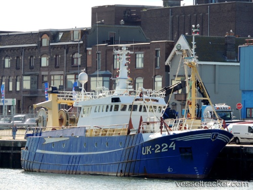
Vessel Uk224 Tunis Van Luut IMO: 9044786, MMSI: 246015000 Fishing Vessel
UTC, 50.72503, 1.58744, course: 247, speed: 0
UTC, 50.72505, 1.58743, course: 245, speed: 0
2026-03-08 02:49:58 UTC, 50.72507, 1.58739, course: 245, speed: 0
Live Vessel Uk224 Tunis Van Luut Analytics (details, animations, etc.)
Live AIS position: UTC. Near BOULOGNE-SUR-MER), updated 2026-03-08 02:49:58 UTC.Find the position of the vessel Uk224 Tunis Van Luut on the map. The latter are known coordinates and path.
marine traffic ship tracker show on live map
The current position of vessel Uk224 Tunis Van Luut is 50.72507 lat / 1.58739 lng. Updated: 2026-03-08 02:49:58 UTCCurrently sailing under the flag of Netherlands
Uk224 Tunis Van Luut built in 1998 year
Details:
Last coordinates of the vessel:
UTC, 50.72507, 1.58736, course: 246, speed: 0UTC, 50.72503, 1.58744, course: 247, speed: 0
UTC, 50.72505, 1.58743, course: 245, speed: 0
2026-03-08 02:49:58 UTC, 50.72507, 1.58739, course: 245, speed: 0