 vesseltracker.com
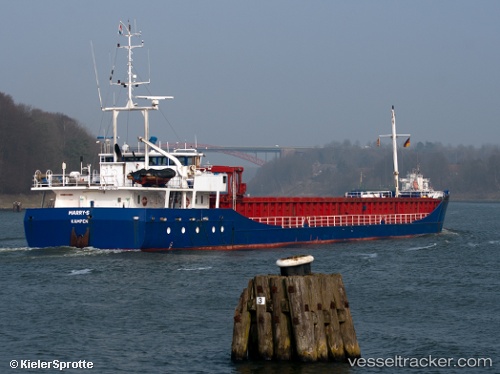
Vessel Marry s IMO: 9148178, MMSI: 246168000 General Cargo Ship
UTC, 53.18942, 5.43144, course: 207, speed: 0
UTC, 53.18943, 5.43148, course: 207, speed: 0
2026-03-02 18:04:43 UTC, 53.18938, 5.43146, course: 207, speed: 0
Live AIS position:
UTC. Near HARLINGEN),
updated 2026-03-02 18:04:43 UTC.
Find the position of the vessel Marry s on the map. The latter are known coordinates and path.
marine traffic ship tracker show on live map
The current position of vessel Marry s is 53.18938 lat / 5.43146 lng. Updated: 2026-03-02 18:04:43 UTCCurrently sailing under the flag of Netherlands
Marry s built in 1997 year
Deadweight:
3471 tDetails:
Last coordinates of the vessel:
UTC, 53.18942, 5.43144, course: 207, speed: 0UTC, 53.18942, 5.43144, course: 207, speed: 0
UTC, 53.18943, 5.43148, course: 207, speed: 0
2026-03-02 18:04:43 UTC, 53.18938, 5.43146, course: 207, speed: 0