 vesseltracker.com
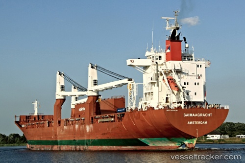
Vessel Saimaagracht IMO: 9288069, MMSI: 246293000 Multi Purpose Carrier
UTC, 42.48012, -65.32827, course: 230, speed: 17.2
UTC, 42.18341, -65.78700, course: 228, speed: 17.3
2026-02-19 06:15:27 UTC, 41.75866, -66.48725, course: 237, speed: 17.1
Live AIS position:
UTC. 108 nm S of CLARK'S HARBOUR),
updated 2026-02-19 06:15:27 UTC.
Find the position of the vessel Saimaagracht on the map. The latter are known coordinates and path.
marine traffic ship tracker show on live map
The current position of vessel Saimaagracht is 41.75866 lat / -66.48725 lng. Updated: 2026-02-19 06:15:27 UTCDetails:
Last coordinates of the vessel:
UTC, 43.09424, -64.63363, course: 211, speed: 16.8UTC, 42.48012, -65.32827, course: 230, speed: 17.2
UTC, 42.18341, -65.78700, course: 228, speed: 17.3
2026-02-19 06:15:27 UTC, 41.75866, -66.48725, course: 237, speed: 17.1