 vesseltracker.com
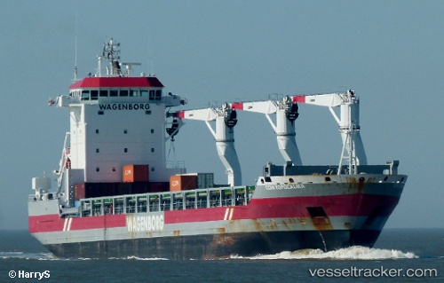
Adriaticborg
Current StatusWhere is the vessel?
Adriaticborg is currently in Near Bekkeri, based on AIS data received about 1h ago.
Latest AIS update:
Current position: 59.46555° N, 24.64900° E (Near Bekkeri)
Average speed (last 7 days): Loading…
Average speed (last 30 days): Loading…
Vessel profile: Adriaticborg is a General Cargo Ship with dimensions 22m x 143m.
This page combines live AIS, route history, probable destination signals, nearby traffic, and port activity for practical vessel monitoring.
The current position of vessel Adriaticborg is 59.46555 lat / 24.64900 lng. Updated: 2026-03-25 23:29:38 UTCNearest reference points:
- Near Aegna
- Near Vanasadam
- Near Nurme
Details:
Live Vessel Adriaticborg Analytics (details, animations, etc.)
Recent AIS points (UTC):
2026-03-25 18:23:39 UTC · 59.46554, 24.64899 · SOG 0 kn · COG 122°2026-03-25 19:47:38 UTC · 59.46555, 24.64900 · SOG 0 kn · COG 121°
2026-03-25 21:41:38 UTC · 59.46555, 24.64901 · SOG 0 kn · COG 121°
2026-03-25 23:29:38 UTC · 59.46555, 24.64900 · SOG 0.1 kn · COG 121°