 vesseltracker.com
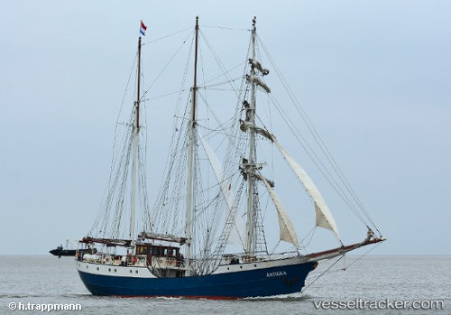
Vessel Antigua IMO: 5019800, MMSI: 246337000 Cruise Ship
UTC, 53.18325, 5.56085, course: 102, speed: 0
UTC, 53.18324, 5.56085, course: 100, speed: 0
2026-01-14 11:28:54 UTC, 53.18326, 5.56085, course: 101, speed: 0
Live AIS position:
UTC. Near FRANEKER),
updated 2026-01-14 11:28:54 UTC.
Find the position of the vessel Antigua on the map. The latter are known coordinates and path.
marine traffic ship tracker show on live map
The current position of vessel Antigua is 53.18326 lat / 5.56085 lng. Updated: 2026-01-14 11:28:54 UTCCurrently sailing under the flag of Netherlands
Antigua built in 1957 year
Details:
Last coordinates of the vessel:
UTC, 53.18325, 5.56085, course: 102, speed: 0UTC, 53.18325, 5.56085, course: 102, speed: 0
UTC, 53.18324, 5.56085, course: 100, speed: 0
2026-01-14 11:28:54 UTC, 53.18326, 5.56085, course: 101, speed: 0