 vesseltracker.com
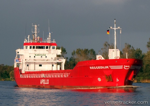
Vessel Reggedijk IMO: 9515034, MMSI: 246455000 Multi Purpose Carrier
UTC, 48.69028, -6.11888, course: -1, speed: 8.8
UTC, 48.43500, -6.31167, course: -1, speed: 9
2026-03-10 09:13:08 UTC, 48.22333, -6.47500, course: -1, speed: 9
Live Vessel Reggedijk Analytics (details, animations, etc.)
Live AIS position: UTC. 36 nm SE of San Clodio), updated 2026-03-10 09:13:08 UTC.Find the position of the vessel Reggedijk on the map. The latter are known coordinates and path.
marine traffic ship tracker show on live map
The current position of vessel Reggedijk is 48.22333 lat / -6.47500 lng. Updated: 2026-03-10 09:13:08 UTCCurrently sailing under the flag of Netherlands
Reggedijk built in 2011 year
Deadweight:
4450 tDetails:
Last coordinates of the vessel:
UTC, 48.91760, -5.94338, course: 207, speed: 9UTC, 48.69028, -6.11888, course: -1, speed: 8.8
UTC, 48.43500, -6.31167, course: -1, speed: 9
2026-03-10 09:13:08 UTC, 48.22333, -6.47500, course: -1, speed: 9