 vesseltracker.com
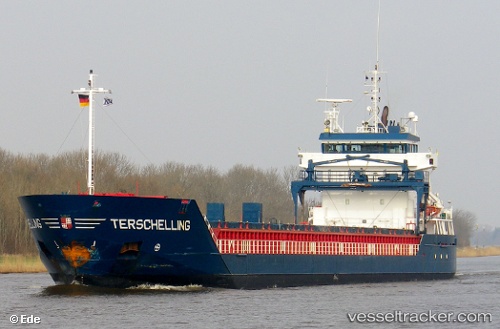
Vessel Terschelling IMO: 9313826, MMSI: 246507000 Multi Purpose Carrier
UTC, 41.10307, 1.23591, course: 243, speed: 0
UTC, 41.10307, 1.23591, course: 243, speed: 0
2026-02-26 11:49:03 UTC, 41.10307, 1.23590, course: 243, speed: 0
Live AIS position:
UTC. Near Tarragona),
updated 2026-02-26 11:49:03 UTC.
Find the position of the vessel Terschelling on the map. The latter are known coordinates and path.
marine traffic ship tracker show on live map
The current position of vessel Terschelling is 41.10307 lat / 1.23590 lng. Updated: 2026-02-26 11:49:03 UTCCurrently sailing under the flag of Netherlands
Terschelling built in 2005 year
Deadweight:
6000 tDetails:
Last coordinates of the vessel:
UTC, 41.10307, 1.23591, course: 243, speed: 0UTC, 41.10307, 1.23591, course: 243, speed: 0
UTC, 41.10307, 1.23591, course: 243, speed: 0
2026-02-26 11:49:03 UTC, 41.10307, 1.23590, course: 243, speed: 0