 vesseltracker.com
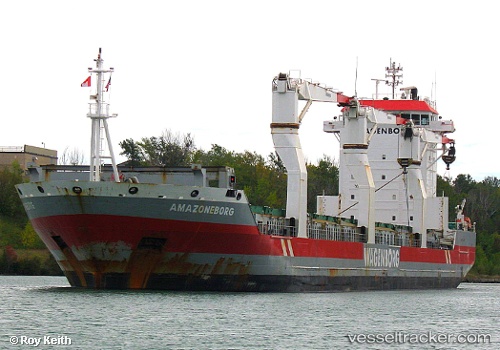
Vessel Amazoneborg IMO: 9333541, MMSI: 246572000 Multi Purpose Carrier
UTC, 51.88096, 4.39578, course: 263, speed: 0
UTC, 51.88097, 4.39579, course: 262, speed: 0
2026-03-14 15:30:19 UTC, 51.88097, 4.39579, course: 262, speed: 0
Live Vessel Amazoneborg Analytics (details, animations, etc.)
Live AIS position: UTC. Near ROTTERDAM PERNIS), updated 2026-03-14 15:30:19 UTC.Find the position of the vessel Amazoneborg on the map. The latter are known coordinates and path.
marine traffic ship tracker show on live map
The current position of vessel Amazoneborg is 51.88097 lat / 4.39579 lng. Updated: 2026-03-14 15:30:19 UTCCurrently sailing under the flag of Netherlands
Amazoneborg built in 2007 year
Deadweight:
17355 tDetails:
Last coordinates of the vessel:
UTC, 51.88097, 4.39578, course: 262, speed: 0UTC, 51.88096, 4.39578, course: 263, speed: 0
UTC, 51.88097, 4.39579, course: 262, speed: 0
2026-03-14 15:30:19 UTC, 51.88097, 4.39579, course: 262, speed: 0