 vesseltracker.com
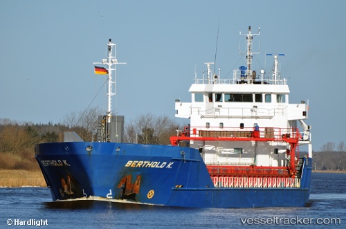
Vessel Berthold K IMO: 9374715, MMSI: 246613000 Multi Purpose Carrier
UTC, 51.88847, 4.43952, course: 241, speed: 0
UTC, 51.88845, 4.43952, course: 241, speed: 0
2026-03-14 15:29:53 UTC, 51.88846, 4.43950, course: 241, speed: 0
Live Vessel Berthold K Analytics (details, animations, etc.)
Live AIS position: UTC. Near DELFSHAVEN), updated 2026-03-14 15:29:53 UTC.Find the position of the vessel Berthold K on the map. The latter are known coordinates and path.
marine traffic ship tracker show on live map
The current position of vessel Berthold K is 51.88846 lat / 4.43950 lng. Updated: 2026-03-14 15:29:53 UTCCurrently sailing under the flag of Netherlands
Berthold K built in 2008 year
Deadweight:
4442 tDetails:
Last coordinates of the vessel:
UTC, 51.88845, 4.43954, course: 242, speed: 0UTC, 51.88847, 4.43952, course: 241, speed: 0
UTC, 51.88845, 4.43952, course: 241, speed: 0
2026-03-14 15:29:53 UTC, 51.88846, 4.43950, course: 241, speed: 0