 vesseltracker.com
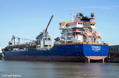
Vessel Stornes IMO: 9549035, MMSI: 246695000 Pipe Burying Vessel
UTC, 60.84949, 5.05225, course: 180, speed: 0
UTC, 60.84949, 5.05224, course: 179, speed: 0
2026-02-05 21:37:16 UTC, 60.84950, 5.05226, course: 179, speed: 0
Live AIS position:
UTC. Near Sløvåg),
updated 2026-02-05 21:37:16 UTC.
Find the position of the vessel Stornes on the map. The latter are known coordinates and path.
marine traffic ship tracker show on live map
The current position of vessel Stornes is 60.84950 lat / 5.05226 lng. Updated: 2026-02-05 21:37:16 UTCCurrently sailing under the flag of Netherlands
Stornes built in 2011 year
Deadweight:
39353 tDetails:
Last coordinates of the vessel:
UTC, 60.84951, 5.05227, course: 179, speed: 0UTC, 60.84949, 5.05225, course: 180, speed: 0
UTC, 60.84949, 5.05224, course: 179, speed: 0
2026-02-05 21:37:16 UTC, 60.84950, 5.05226, course: 179, speed: 0