 vesseltracker.com
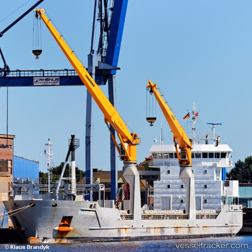
Vessel Bandura IMO: 9526071, MMSI: 246733000 Multi Purpose Carrier
UTC, -21.85300, -41.02013, course: 251, speed: 0
UTC, -21.85297, -41.02012, course: 252, speed: 0
2026-02-04 13:35:25 UTC, -21.85188, -41.01009, course: 62, speed: 7.4
Live AIS position:
UTC. Near PORTO DO ACU),
updated 2026-02-04 13:35:25 UTC.
Find the position of the vessel Bandura on the map. The latter are known coordinates and path.
marine traffic ship tracker show on live map
The current position of vessel Bandura is -21.85188 lat / -41.01009 lng. Updated: 2026-02-04 13:35:25 UTCCurrently sailing under the flag of Netherlands
Bandura built in 2010 year
Deadweight:
8217 tDetails:
Last coordinates of the vessel:
UTC, -21.85333, -41.01667, course: -1, speed: 1UTC, -21.85300, -41.02013, course: 251, speed: 0
UTC, -21.85297, -41.02012, course: 252, speed: 0
2026-02-04 13:35:25 UTC, -21.85188, -41.01009, course: 62, speed: 7.4