 vesseltracker.com
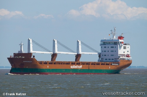
Vessel Marsgracht IMO: 9571507, MMSI: 246767000 General Cargo Ship
UTC, 64.14875, -21.84170, course: 315, speed: 0
UTC, 64.14867, -21.84168, course: 315, speed: 0
2026-03-13 06:17:50 UTC, 64.14867, -21.84165, course: 315, speed: 0
Live Vessel Marsgracht Analytics (details, animations, etc.)
Live AIS position: UTC. Near Reykjavik), updated 2026-03-13 06:17:50 UTC.Find the position of the vessel Marsgracht on the map. The latter are known coordinates and path.
marine traffic ship tracker show on live map
The current position of vessel Marsgracht is 64.14867 lat / -21.84165 lng. Updated: 2026-03-13 06:17:50 UTCDetails:
Last coordinates of the vessel:
UTC, 64.14863, -21.84160, course: 315, speed: 0UTC, 64.14875, -21.84170, course: 315, speed: 0
UTC, 64.14867, -21.84168, course: 315, speed: 0
2026-03-13 06:17:50 UTC, 64.14867, -21.84165, course: 315, speed: 0