 vesseltracker.com
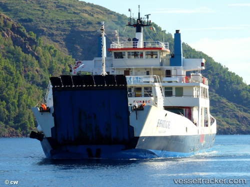
Vessel Bridge IMO: 7817830, MMSI: 247054100 Passenger Ro Ro Cargo Ship
UTC, 38.21631, 15.25580, course: -1, speed: 10.8
UTC, 38.21631, 15.25580, course: -1, speed: 10.8
2026-03-03 02:32:11 UTC, 38.21631, 15.25580, course: -1, speed: 10.8
Live AIS position:
UTC. Near Milazzo),
updated 2026-03-03 02:32:11 UTC.
Find the position of the vessel Bridge on the map. The latter are known coordinates and path.
marine traffic ship tracker show on live map
The current position of vessel Bridge is 38.21631 lat / 15.25580 lng. Updated: 2026-03-03 02:32:11 UTCCurrently sailing under the flag of Italy
Bridge built in 1979 year
Deadweight:
1452 tDetails:
Last coordinates of the vessel:
UTC, 38.23728, 15.27299, course: -1, speed: 11UTC, 38.21631, 15.25580, course: -1, speed: 10.8
UTC, 38.21631, 15.25580, course: -1, speed: 10.8
2026-03-03 02:32:11 UTC, 38.21631, 15.25580, course: -1, speed: 10.8