 vesseltracker.com
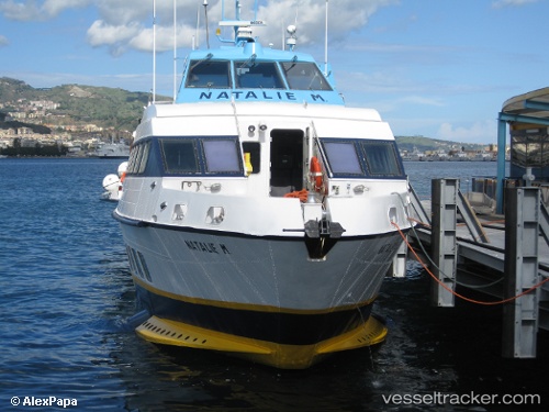
Vessel Natalie M IMO: 9063859, MMSI: 247061300 Passenger Ship
UTC, 38.52921, 14.87007, course: 177, speed: 34.9
UTC, 38.52921, 14.87007, course: 177, speed: 34.9
2026-01-15 16:58:46 UTC, 38.52921, 14.87007, course: 177, speed: 34.9
Live AIS position:
UTC. Near Rinella),
updated 2026-01-15 16:58:46 UTC.
Find the position of the vessel Natalie M on the map. The latter are known coordinates and path.
marine traffic ship tracker show on live map
The current position of vessel Natalie M is 38.52921 lat / 14.87007 lng. Updated: 2026-01-15 16:58:46 UTCDetails:
Last coordinates of the vessel:
UTC, 38.52921, 14.87007, course: 177, speed: 34.9UTC, 38.52921, 14.87007, course: 177, speed: 34.9
UTC, 38.52921, 14.87007, course: 177, speed: 34.9
2026-01-15 16:58:46 UTC, 38.52921, 14.87007, course: 177, speed: 34.9