 vesseltracker.com
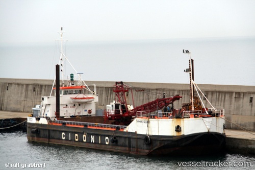
Vessel San Marco Secondo IMO: 7510731, MMSI: 247062300 General Cargo Ship
UTC, 44.26153, 8.45530, course: -1, speed: 0
UTC, 44.26160, 8.45533, course: -1, speed: 0
2026-03-10 07:43:46 UTC, 44.26150, 8.45537, course: -1, speed: 0
Live Vessel San Marco Secondo Analytics (details, animations, etc.)
Live AIS position: UTC. Near Rada Di Vado), updated 2026-03-10 07:43:46 UTC.Find the position of the vessel San Marco Secondo on the map. The latter are known coordinates and path.
marine traffic ship tracker show on live map
The current position of vessel San Marco Secondo is 44.26150 lat / 8.45537 lng. Updated: 2026-03-10 07:43:46 UTCCurrently sailing under the flag of Italy
San Marco Secondo built in 1974 year
Deadweight:
1982 tDetails:
Last coordinates of the vessel:
UTC, 44.26153, 8.45530, course: -1, speed: 0UTC, 44.26153, 8.45530, course: -1, speed: 0
UTC, 44.26160, 8.45533, course: -1, speed: 0
2026-03-10 07:43:46 UTC, 44.26150, 8.45537, course: -1, speed: 0