 vesseltracker.com
Find the position of the vessel Maria M on the map. The latter are known coordinates and path.
marine traffic ship tracker show on live map
The current position of vessel Maria M is 41.4308 lat / 2.64828 lng. Updated: 2024-05-07 05:27:20 UTCCurrently sailing under the flag of Italy
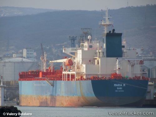
Maria M built in 2006 year
Port of registry:
Bari (Italian city, capital of the Apulia region)Deadweight:
40057 tGross tonnage:
25373Service entry:
2006-01-01T00:00:00ZDetails:
Last coordinates of the vessel:
UTC, 41.5736, 3.06138, course: 244, speed: 12.3UTC, 41.5736, 3.06138, course: 244, speed: 12.3
UTC, 41.4903, 2.81877, course: 244, speed: 12
2024-05-07 05:27:20 UTC, 41.4308, 2.64828, course: 245, speed: 12.1