 vesseltracker.com
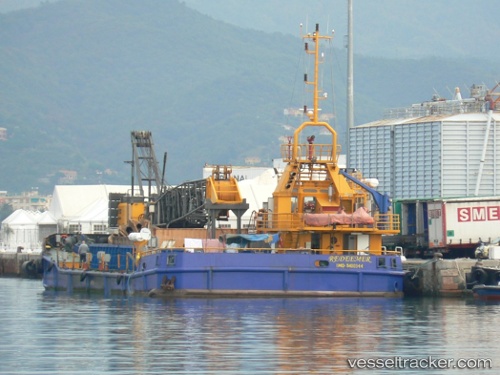
Vessel REDEEMER IMO: 9400344, MMSI: 247277900 Pollution Control Vessel
UTC, 44.41741, 8.79745, course: -1, speed: 0
UTC, 44.41757, 8.79750, course: -1, speed: 0
2026-01-16 09:31:49 UTC, 44.41757, 8.79749, course: -1, speed: 0
Live AIS position:
UTC. Near Multedo),
updated 2026-01-16 09:31:49 UTC.
Find the position of the vessel REDEEMER on the map. The latter are known coordinates and path.
marine traffic ship tracker show on live map
The current position of vessel REDEEMER is 44.41757 lat / 8.79749 lng. Updated: 2026-01-16 09:31:49 UTCCurrently sailing under the flag of Italy
REDEEMER built in 2010 year
Deadweight:
700 tDetails:
Last coordinates of the vessel:
UTC, 44.41741, 8.79747, course: -1, speed: 0UTC, 44.41741, 8.79745, course: -1, speed: 0
UTC, 44.41757, 8.79750, course: -1, speed: 0
2026-01-16 09:31:49 UTC, 44.41757, 8.79749, course: -1, speed: 0