 vesseltracker.com
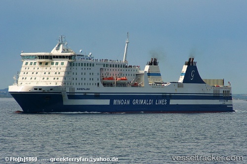
Vessel EUROPALINK IMO: 9319454, MMSI: 247415800 Ro-Ro/Passenger Ship
UTC, 40.53532, 18.54538, course: -1, speed: 19.5
UTC, 40.64717, 17.96048, course: -1, speed: 0
2026-03-03 09:53:46 UTC, 40.64718, 17.96048, course: -1, speed: 0
Live AIS position:
UTC. Near Porto Di Brindisi),
updated 2026-03-03 09:53:46 UTC.
Find the position of the vessel EUROPALINK on the map. The latter are known coordinates and path.
marine traffic ship tracker show on live map
The current position of vessel EUROPALINK is 40.64718 lat / 17.96048 lng. Updated: 2026-03-03 09:53:46 UTCCurrently sailing under the flag of Italy
Details:
Last coordinates of the vessel:
UTC, 40.24200, 19.19768, course: -1, speed: 19.6UTC, 40.53532, 18.54538, course: -1, speed: 19.5
UTC, 40.64717, 17.96048, course: -1, speed: 0
2026-03-03 09:53:46 UTC, 40.64718, 17.96048, course: -1, speed: 0