 vesseltracker.com
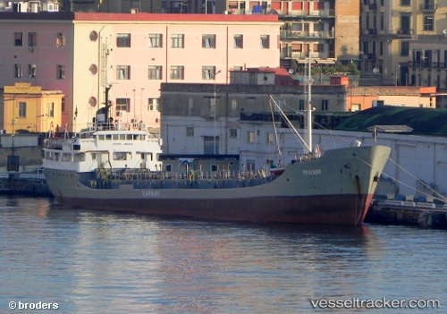
Vessel Praiano IMO: 6826418, MMSI: 247531000 Water Tanker
UTC, 38.46401, 15.90767, course: -1, speed: 0
UTC, 38.46401, 15.90767, course: -1, speed: 0
2026-01-16 14:00:54 UTC, 38.46400, 15.90767, course: -1, speed: 0
Live AIS position:
UTC. Near GIOIA TAURO),
updated 2026-01-16 14:00:54 UTC.
Find the position of the vessel Praiano on the map. The latter are known coordinates and path.
marine traffic ship tracker show on live map
The current position of vessel Praiano is 38.46400 lat / 15.90767 lng. Updated: 2026-01-16 14:00:54 UTCDetails:
Last coordinates of the vessel:
UTC, 38.46399, 15.90767, course: -1, speed: 0UTC, 38.46401, 15.90767, course: -1, speed: 0
UTC, 38.46401, 15.90767, course: -1, speed: 0
2026-01-16 14:00:54 UTC, 38.46400, 15.90767, course: -1, speed: 0