 vesseltracker.com
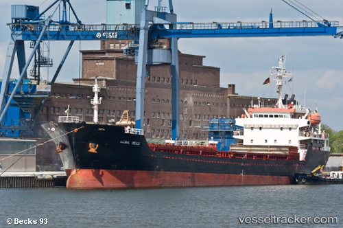
Vessel Dakota IMO: 9349980, MMSI: 248038000 Bulk Carrier
UTC, 44.10121, 28.65875, course: 180, speed: 0
UTC, 44.10123, 28.65878, course: 180, speed: 0
2026-01-16 21:21:17 UTC, 44.10122, 28.65876, course: 181, speed: 0
Live AIS position:
UTC. Near Agigea),
updated 2026-01-16 21:21:17 UTC.
Find the position of the vessel Dakota on the map. The latter are known coordinates and path.
marine traffic ship tracker show on live map
The current position of vessel Dakota is 44.10122 lat / 28.65876 lng. Updated: 2026-01-16 21:21:17 UTCCurrently sailing under the flag of Malta
Dakota built in 2006 year
Deadweight:
7448 tDetails:
Last coordinates of the vessel:
UTC, 44.10122, 28.65875, course: 180, speed: 0UTC, 44.10121, 28.65875, course: 180, speed: 0
UTC, 44.10123, 28.65878, course: 180, speed: 0
2026-01-16 21:21:17 UTC, 44.10122, 28.65876, course: 181, speed: 0