 vesseltracker.com
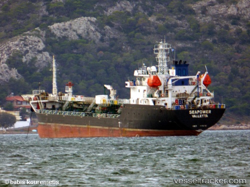
Find the position of the vessel Seapower on the map. The latter are known coordinates and path.
marine traffic ship tracker show on live map
The current position of vessel Seapower is 40.8503 lat / 29.288 lng. Updated: 2024-05-04 14:09:14 UTCCurrently sailing under the flag of Malta
Payload_mass:
4897 tonneGross tonnage:
3726Service entry:
2009-01-01T00:00:00ZDetails:
Last coordinates of the vessel:
UTC, 40.8503, 29.288, course: 72, speed: 0UTC, 40.8503, 29.288, course: 72, speed: 0
UTC, 40.8503, 29.288, course: 72, speed: 0
2024-05-04 14:09:14 UTC, 40.8503, 29.288, course: 72, speed: 0