 vesseltracker.com
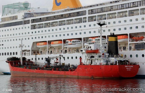
Vessel Santa Elena IMO: 8125600, MMSI: 248230000 Oil Products Tanker
UTC, 35.81789, 14.54223, course: 317, speed: 0
UTC, 35.81788, 14.54220, course: 318, speed: 0
2026-03-24 21:56:25 UTC, 35.81846, 14.57270, course: 57, speed: 7.3
Live Vessel Santa Elena Analytics (details, animations, etc.)
Live AIS position: UTC. Near Marsaxlokk), updated 2026-03-24 21:56:25 UTC.Find the position of the vessel Santa Elena on the map. The latter are known coordinates and path.
marine traffic ship tracker show on live map
The current position of vessel Santa Elena is 35.81846 lat / 14.57270 lng. Updated: 2026-03-24 21:56:25 UTCCurrently sailing under the flag of Malta
Santa Elena built in 1982 year
Deadweight:
2825 tDetails:
Last coordinates of the vessel:
UTC, 35.81786, 14.54217, course: 319, speed: 0.2UTC, 35.81789, 14.54223, course: 317, speed: 0
UTC, 35.81788, 14.54220, course: 318, speed: 0
2026-03-24 21:56:25 UTC, 35.81846, 14.57270, course: 57, speed: 7.3