 vesseltracker.com
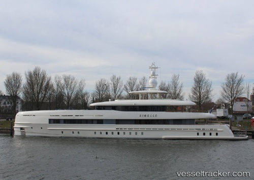
Vessel Sibelle IMO: 9763899, MMSI: 248394000 Service Ship
UTC, 35.89097, 14.51800, course: 218, speed: 0
UTC, 35.89097, 14.51802, course: 218, speed: 0
2026-01-15 20:11:22 UTC, 35.89096, 14.51797, course: 218, speed: 0
Live AIS position:
UTC. Near Birgu (Vittoriosa)),
updated 2026-01-15 20:11:22 UTC.
Find the position of the vessel Sibelle on the map. The latter are known coordinates and path.
marine traffic ship tracker show on live map
The current position of vessel Sibelle is 35.89096 lat / 14.51797 lng. Updated: 2026-01-15 20:11:22 UTCCurrently sailing under the flag of Malta
Details:
Last coordinates of the vessel:
UTC, 35.89096, 14.51800, course: 217, speed: 0UTC, 35.89097, 14.51800, course: 218, speed: 0
UTC, 35.89097, 14.51802, course: 218, speed: 0
2026-01-15 20:11:22 UTC, 35.89096, 14.51797, course: 218, speed: 0