 vesseltracker.com
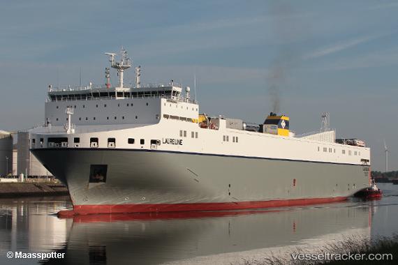
Vessel Laureline IMO: 9823352, MMSI: 248743000 Ro Ro Cargo Ship
UTC, 53.34342, -6.16027, course: 89, speed: 7.6
UTC, 52.71621, -5.87235, course: 172, speed: 20.7
2026-03-06 16:20:26 UTC, 51.91278, -5.89110, course: -1, speed: 19.3
Live Vessel Laureline Analytics (details, animations, etc.)
Live AIS position: UTC. 23 nm W of Saint David's), updated 2026-03-06 16:20:26 UTC.Find the position of the vessel Laureline on the map. The latter are known coordinates and path.
marine traffic ship tracker show on live map
The current position of vessel Laureline is 51.91278 lat / -5.89110 lng. Updated: 2026-03-06 16:20:26 UTCCurrently sailing under the flag of Malta
Details:
Last coordinates of the vessel:
UTC, 53.34535, -6.21025, course: 148, speed: 0UTC, 53.34342, -6.16027, course: 89, speed: 7.6
UTC, 52.71621, -5.87235, course: 172, speed: 20.7
2026-03-06 16:20:26 UTC, 51.91278, -5.89110, course: -1, speed: 19.3