 vesseltracker.com
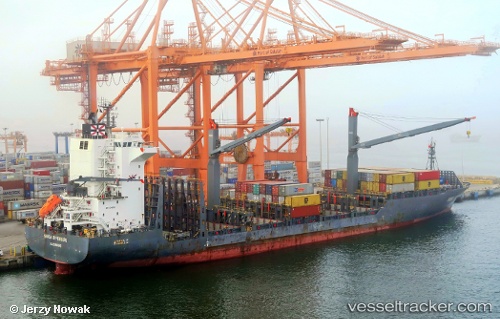
Vessel ANL KOKODA IMO: 9516765, MMSI: 248756000 Container Ship
UTC, 2.94320, 101.29927, course: 30, speed: 0
UTC, 2.94320, 101.29925, course: 30, speed: 0
2026-01-15 21:43:07 UTC, 2.94320, 101.29925, course: 30, speed: 0
Live AIS position:
UTC. Near Westport/Port Klang),
updated 2026-01-15 21:43:07 UTC.
Find the position of the vessel ANL KOKODA on the map. The latter are known coordinates and path.
marine traffic ship tracker show on live map
The current position of vessel ANL KOKODA is 2.94320 lat / 101.29925 lng. Updated: 2026-01-15 21:43:07 UTCCurrently sailing under the flag of Malta
ANL KOKODA built in 2011 year
Deadweight:
23314 tDetails:
Last coordinates of the vessel:
UTC, 2.94320, 101.29927, course: 30, speed: 0UTC, 2.94320, 101.29927, course: 30, speed: 0
UTC, 2.94320, 101.29925, course: 30, speed: 0
2026-01-15 21:43:07 UTC, 2.94320, 101.29925, course: 30, speed: 0