 vesseltracker.com
Find the position of the vessel Titus on the map. The latter are known coordinates and path.
marine traffic ship tracker show on live map
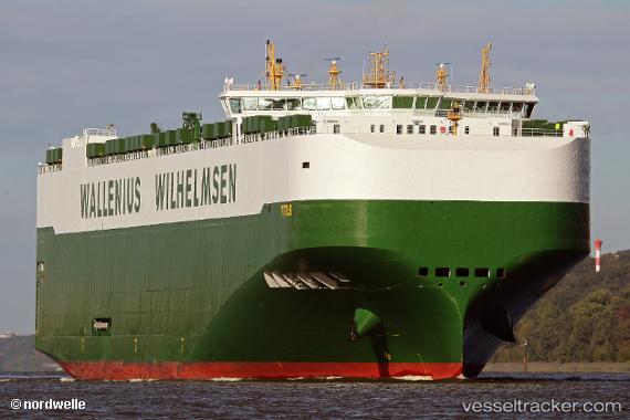
The current position of vessel Titus is 14.2091 lat / -77.3119 lng. Updated: 2025-07-04 16:47:45 UTCCurrently sailing under the flag of Malta
Port of registry:
Valletta (capital of Malta)Speed:
19 knotPayload_mass:
23889 tonneGross tonnage:
73358Service entry:
2018-01-01T00:00:00ZDetails:
Last coordinates of the vessel:
UTC, 14.8561, -76.9451, course: 207, speed: 15.5UTC, 14.5993, -77.0918, course: 206, speed: 15.1
UTC, 14.401, -77.2038, course: 205, speed: 15.1
2025-07-04 16:47:45 UTC, 14.2091, -77.3119, course: 203, speed: 14.7