 vesseltracker.com
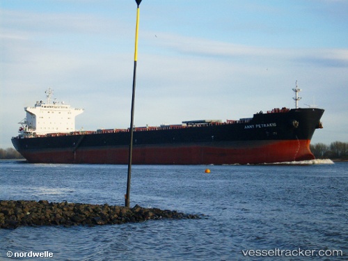
Vessel Anny Petrakis IMO: 9357767, MMSI: 249025000 Bulk Carrier
UTC, 26.33943, 121.15539, course: 191, speed: 11.9
UTC, 26.18620, 121.02660, course: 218, speed: 11.8
2026-01-15 13:35:03 UTC, 25.86616, 120.75505, course: 230, speed: 11.1
Live AIS position:
UTC. 52 nm NW of Sha-lun),
updated 2026-01-15 13:35:03 UTC.
Find the position of the vessel Anny Petrakis on the map. The latter are known coordinates and path.
marine traffic ship tracker show on live map
The current position of vessel Anny Petrakis is 25.86616 lat / 120.75505 lng. Updated: 2026-01-15 13:35:03 UTCCurrently sailing under the flag of Malta
Anny Petrakis built in 2008 year
Deadweight:
74500 tDetails:
Last coordinates of the vessel:
UTC, 26.37971, 121.16939, course: 198, speed: 11.9UTC, 26.33943, 121.15539, course: 191, speed: 11.9
UTC, 26.18620, 121.02660, course: 218, speed: 11.8
2026-01-15 13:35:03 UTC, 25.86616, 120.75505, course: 230, speed: 11.1