 vesseltracker.com
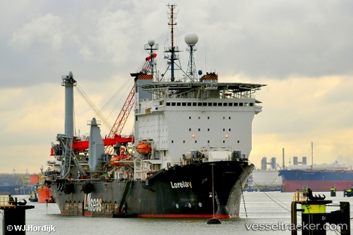
Vessel Lorelay IMO: 7349807, MMSI: 249119000 Pipe Layer
UTC, 58.15627, 8.03551, course: 183, speed: 0
UTC, 58.15627, 8.03552, course: 183, speed: 0
2026-03-03 04:03:54 UTC, 58.15628, 8.03553, course: 183, speed: 0
Live AIS position:
UTC. Near Kristiansand),
updated 2026-03-03 04:03:54 UTC.
Find the position of the vessel Lorelay on the map. The latter are known coordinates and path.
marine traffic ship tracker show on live map
The current position of vessel Lorelay is 58.15628 lat / 8.03553 lng. Updated: 2026-03-03 04:03:54 UTCCurrently sailing under the flag of Malta
Lorelay built in 1974 year
Deadweight:
8795 tDetails:
Last coordinates of the vessel:
UTC, 58.15627, 8.03551, course: -1, speed: 0UTC, 58.15627, 8.03551, course: 183, speed: 0
UTC, 58.15627, 8.03552, course: 183, speed: 0
2026-03-03 04:03:54 UTC, 58.15628, 8.03553, course: 183, speed: 0