 vesseltracker.com
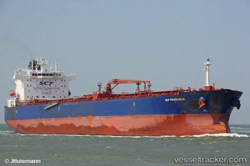
Vessel NORTHERNLIGHT IMO: 9577123, MMSI: 249182000 Crude Oil Tanker
UTC, 38.29312, 25.22414, course: 16, speed: 9.7
UTC, 38.30694, 25.22867, course: 15, speed: 9.7
2026-01-19 03:16:28 UTC, 38.38773, 25.23378, course: 317, speed: 1
Live AIS position:
UTC. 18 nm SW of Psará),
updated 2026-01-19 03:16:28 UTC.
Find the position of the vessel NORTHERNLIGHT on the map. The latter are known coordinates and path.
marine traffic ship tracker show on live map
The current position of vessel NORTHERNLIGHT is 38.38773 lat / 25.23378 lng. Updated: 2026-01-19 03:16:28 UTCCurrently sailing under the flag of Bahamas
NORTHERNLIGHT built in 2012 year
Deadweight:
74565 tDetails:
Last coordinates of the vessel:
UTC, 38.22541, 25.20032, course: 103, speed: 1.1UTC, 38.29312, 25.22414, course: 16, speed: 9.7
UTC, 38.30694, 25.22867, course: 15, speed: 9.7
2026-01-19 03:16:28 UTC, 38.38773, 25.23378, course: 317, speed: 1