 vesseltracker.com
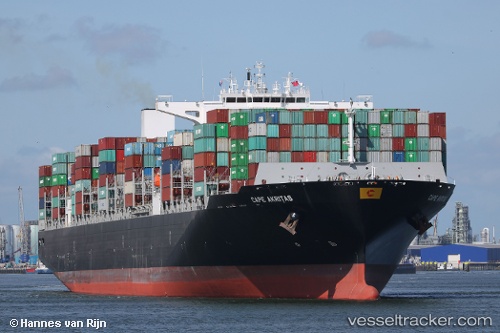
Vessel Cape Akritas IMO: 9706190, MMSI: 249202000 Container Ship
UTC, 54.17466, -155.72214, course: 274, speed: 13
UTC, 54.15232, -156.58916, course: 272, speed: 13.9
2026-03-24 20:00:15 UTC, 54.14674, -157.44139, course: 271, speed: 13.1
Live Vessel Cape Akritas Analytics (details, animations, etc.)
Live AIS position: UTC. 182 nm E of Lenard Harbour), updated 2026-03-24 20:00:15 UTC.Find the position of the vessel Cape Akritas on the map. The latter are known coordinates and path.
marine traffic ship tracker show on live map
The current position of vessel Cape Akritas is 54.14674 lat / -157.44139 lng. Updated: 2026-03-24 20:00:15 UTCCurrently sailing under the flag of Malta
Details:
Last coordinates of the vessel:
UTC, 54.16736, -155.27695, course: 273, speed: 13.2UTC, 54.17466, -155.72214, course: 274, speed: 13
UTC, 54.15232, -156.58916, course: 272, speed: 13.9
2026-03-24 20:00:15 UTC, 54.14674, -157.44139, course: 271, speed: 13.1