 vesseltracker.com
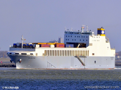
Vessel Wilhelmine IMO: 9539080, MMSI: 249239000 Ro Ro Cargo Ship
UTC, 51.48367, 0.99128, course: 79, speed: 14.1
UTC, 51.60281, 1.95194, course: 67, speed: 16.1
2026-03-04 04:11:56 UTC, 51.57296, 2.61724, course: 89, speed: 14.5
Live AIS position:
UTC. 12 nm W of Thorntonbank),
updated 2026-03-04 04:11:56 UTC.
Find the position of the vessel Wilhelmine on the map. The latter are known coordinates and path.
marine traffic ship tracker show on live map
The current position of vessel Wilhelmine is 51.57296 lat / 2.61724 lng. Updated: 2026-03-04 04:11:56 UTCCurrently sailing under the flag of Malta
Wilhelmine built in 2012 year
Deadweight:
6374 tDetails:
Last coordinates of the vessel:
UTC, 51.47500, 0.23167, course: -1, speed: 9UTC, 51.48367, 0.99128, course: 79, speed: 14.1
UTC, 51.60281, 1.95194, course: 67, speed: 16.1
2026-03-04 04:11:56 UTC, 51.57296, 2.61724, course: 89, speed: 14.5