 vesseltracker.com
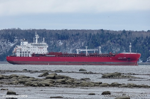
Vessel Hafnia Lise IMO: 9726621, MMSI: 249338000 Chemical Oil Products Tanker
UTC, 29.13134, -87.42497, course: 182, speed: 13.4
UTC, 28.72934, -87.40110, course: 178, speed: 13.2
2026-02-03 18:32:25 UTC, 28.50531, -87.38355, course: 176, speed: 13.1
Live AIS position:
UTC. 98 nm E of Port Eads),
updated 2026-02-03 18:32:25 UTC.
Find the position of the vessel Hafnia Lise on the map. The latter are known coordinates and path.
marine traffic ship tracker show on live map
The current position of vessel Hafnia Lise is 28.50531 lat / -87.38355 lng. Updated: 2026-02-03 18:32:25 UTCCurrently sailing under the flag of Malta
Details:
Last coordinates of the vessel:
UTC, 29.45261, -87.47972, course: 152, speed: 13.4UTC, 29.13134, -87.42497, course: 182, speed: 13.4
UTC, 28.72934, -87.40110, course: 178, speed: 13.2
2026-02-03 18:32:25 UTC, 28.50531, -87.38355, course: 176, speed: 13.1