 vesseltracker.com
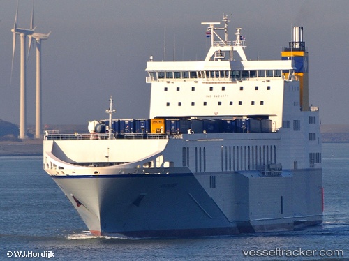
Vessel Amandine IMO: 9424871, MMSI: 249679000 Ro Ro Cargo Ship
Live AIS position:
UTC. Near Zeebrugge),
updated 2026-02-22 12:48:41 UTC.
Find the position of the vessel Amandine on the map. The latter are known coordinates and path.
marine traffic ship tracker show on live map
The current position of vessel Amandine is 51.34070 lat / 3.21605 lng. Updated: 2026-02-22 12:48:41 UTCCurrently sailing under the flag of Malta
Amandine built in 2011 year
Deadweight:
13428 tDetails:
Last coordinates of the vessel:
2026-02-22 12:48:41 UTC, 51.34070, 3.21605, course: 350, speed: 0