 vesseltracker.com
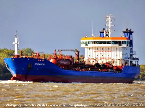
Vessel C Force IMO: 9393072, MMSI: 249706000 Chemical Oil Products Tanker
UTC, 53.48954, -3.42393, course: 124, speed: 0.1
UTC, 53.49006, -3.42419, course: 135, speed: 0
2026-01-16 03:41:57 UTC, 53.49047, -3.42385, course: 161, speed: 0.1
Live AIS position:
UTC. Near LIVERPOOL ANCH),
updated 2026-01-16 03:41:57 UTC.
Find the position of the vessel C Force on the map. The latter are known coordinates and path.
marine traffic ship tracker show on live map
The current position of vessel C Force is 53.49047 lat / -3.42385 lng. Updated: 2026-01-16 03:41:57 UTCCurrently sailing under the flag of Malta
C Force built in 2009 year
Deadweight:
10303 tDetails:
Last coordinates of the vessel:
UTC, 53.48958, -3.42382, course: 127, speed: 0UTC, 53.48954, -3.42393, course: 124, speed: 0.1
UTC, 53.49006, -3.42419, course: 135, speed: 0
2026-01-16 03:41:57 UTC, 53.49047, -3.42385, course: 161, speed: 0.1