 vesseltracker.com
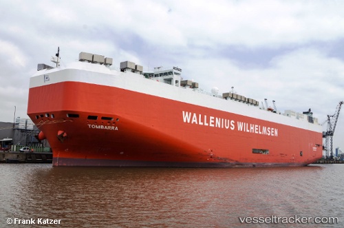
Vessel Tombarra IMO: 9319753, MMSI: 249758000 Vehicles Carrier
UTC, 20.27802, 69.37650, course: 157, speed: 17.3
UTC, 19.76955, 69.58162, course: 160, speed: 17.3
2026-02-01 06:09:18 UTC, 19.06494, 69.86058, course: 160, speed: 17.3
Live AIS position:
UTC. 111 nm SW of Mul Dwårka),
updated 2026-02-01 06:09:18 UTC.
Find the position of the vessel Tombarra on the map. The latter are known coordinates and path.
marine traffic ship tracker show on live map
The current position of vessel Tombarra is 19.06494 lat / 69.86058 lng. Updated: 2026-02-01 06:09:18 UTCCurrently sailing under the flag of Malta
Tombarra built in 2006 year
Deadweight:
22149 tDetails:
Last coordinates of the vessel:
UTC, 20.80763, 69.15721, course: 159, speed: 16.9UTC, 20.27802, 69.37650, course: 157, speed: 17.3
UTC, 19.76955, 69.58162, course: 160, speed: 17.3
2026-02-01 06:09:18 UTC, 19.06494, 69.86058, course: 160, speed: 17.3