 vesseltracker.com
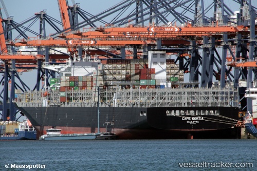
Vessel Cape Kortia IMO: 9727613, MMSI: 249783000 Container Ship
UTC, 48.15821, -125.24877, course: 212, speed: 5.4
UTC, 47.91705, -125.36362, course: 208, speed: 7.7
2026-03-25 02:13:59 UTC, 47.60131, -125.43544, course: 192, speed: 8.8
Live Vessel Cape Kortia Analytics (details, animations, etc.)
Live AIS position: UTC. 55 nm SW of Tatoosh Island), updated 2026-03-25 02:13:59 UTC.Find the position of the vessel Cape Kortia on the map. The latter are known coordinates and path.
marine traffic ship tracker show on live map
The current position of vessel Cape Kortia is 47.60131 lat / -125.43544 lng. Updated: 2026-03-25 02:13:59 UTCDetails:
Last coordinates of the vessel:
UTC, 48.32374, -125.16273, course: 201, speed: 7UTC, 48.15821, -125.24877, course: 212, speed: 5.4
UTC, 47.91705, -125.36362, course: 208, speed: 7.7
2026-03-25 02:13:59 UTC, 47.60131, -125.43544, course: 192, speed: 8.8