 vesseltracker.com
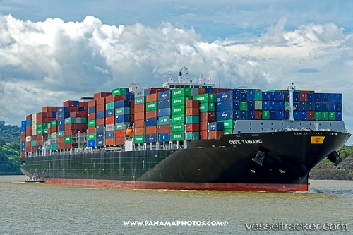
Vessel Cape Tainaro IMO: 9706205, MMSI: 249982000 Container Ship
UTC, 20.89276, -44.48325, course: 256, speed: 16.8
UTC, 20.75988, -45.02476, course: 257, speed: 17
2026-03-06 13:59:46 UTC, 20.59736, -45.73290, course: 255, speed: 16.7
Live Vessel Cape Tainaro Analytics (details, animations, etc.)
Live AIS position: UTC. 22 nm SW of Upper Northfield), updated 2026-03-06 13:59:46 UTC.Find the position of the vessel Cape Tainaro on the map. The latter are known coordinates and path.
marine traffic ship tracker show on live map
The current position of vessel Cape Tainaro is 20.59736 lat / -45.73290 lng. Updated: 2026-03-06 13:59:46 UTCCurrently sailing under the flag of Malta
Details:
Last coordinates of the vessel:
UTC, 21.03701, -43.82519, course: 256, speed: 16.8UTC, 20.89276, -44.48325, course: 256, speed: 16.8
UTC, 20.75988, -45.02476, course: 257, speed: 17
2026-03-06 13:59:46 UTC, 20.59736, -45.73290, course: 255, speed: 16.7