 vesseltracker.com
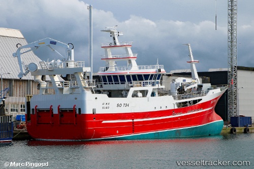
Vessel Aine IMO: 9794886, MMSI: 250004765 Fishing Vessel
UTC, 54.63361, -8.44355, course: 203, speed: 0
UTC, 54.63359, -8.44353, course: 203, speed: 0
2026-03-15 21:51:48 UTC, 54.63359, -8.44351, course: 203, speed: 0
Live Vessel Aine Analytics (details, animations, etc.)
Live AIS position: UTC. Near KILLYBEGS), updated 2026-03-15 21:51:48 UTC.Find the position of the vessel Aine on the map. The latter are known coordinates and path.
marine traffic ship tracker show on live map
The current position of vessel Aine is 54.63359 lat / -8.44351 lng. Updated: 2026-03-15 21:51:48 UTCCurrently sailing under the flag of Ireland
Details:
Last coordinates of the vessel:
UTC, 54.63361, -8.44357, course: 203, speed: 0UTC, 54.63361, -8.44355, course: 203, speed: 0
UTC, 54.63359, -8.44353, course: 203, speed: 0
2026-03-15 21:51:48 UTC, 54.63359, -8.44351, course: 203, speed: 0