 vesseltracker.com
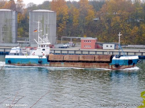
Vessel Mary IMO: 8857148, MMSI: 251848740 Deck Cargo Ship
UTC, 53.52414, 8.14719, course: -1, speed: 0
UTC, 53.52406, 8.14721, course: -1, speed: 0
2026-01-14 17:26:19 UTC, 53.52405, 8.14718, course: -1, speed: 0.1
Live AIS position:
UTC. Near Wilhelmshaven),
updated 2026-01-14 17:26:19 UTC.
Find the position of the vessel Mary on the map. The latter are known coordinates and path.
marine traffic ship tracker show on live map
The current position of vessel Mary is 53.52405 lat / 8.14718 lng. Updated: 2026-01-14 17:26:19 UTCCurrently sailing under the flag of Iceland
Mary built in 1985 year
Deadweight:
563 tDetails:
Last coordinates of the vessel:
UTC, 53.52404, 8.14726, course: -1, speed: 0UTC, 53.52414, 8.14719, course: -1, speed: 0
UTC, 53.52406, 8.14721, course: -1, speed: 0
2026-01-14 17:26:19 UTC, 53.52405, 8.14718, course: -1, speed: 0.1