 vesseltracker.com
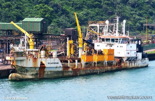
Vessel De Laperouse IMO: 9462603, MMSI: 253046000 Pollution Control Vessel
UTC, 39.44255, -0.29898, course: 27, speed: 1.4
UTC, 39.44190, -0.29913, course: 196, speed: 1.5
2026-01-29 05:48:32 UTC, 39.44218, -0.29900, course: 223, speed: 0.4
Live AIS position:
UTC. Near Valencia),
updated 2026-01-29 05:48:32 UTC.
Find the position of the vessel De Laperouse on the map. The latter are known coordinates and path.
marine traffic ship tracker show on live map
The current position of vessel De Laperouse is 39.44218 lat / -0.29900 lng. Updated: 2026-01-29 05:48:32 UTCCurrently sailing under the flag of Luxembourg
Details:
Last coordinates of the vessel:
UTC, 39.44015, -0.30060, course: 176, speed: 1.1UTC, 39.44255, -0.29898, course: 27, speed: 1.4
UTC, 39.44190, -0.29913, course: 196, speed: 1.5
2026-01-29 05:48:32 UTC, 39.44218, -0.29900, course: 223, speed: 0.4