 vesseltracker.com
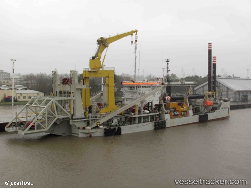
Vessel Ibn Battuta IMO: 9448970, MMSI: 253291000 Dredger
UTC, 39.44333, -0.29667, course: -1, speed: 0
UTC, 39.44357, -0.29699, course: 352, speed: 0.6
2026-03-01 14:27:17 UTC, 39.44365, -0.29757, course: 46, speed: 0.5
Live AIS position:
UTC. Near Valencia),
updated 2026-03-01 14:27:17 UTC.
Find the position of the vessel Ibn Battuta on the map. The latter are known coordinates and path.
marine traffic ship tracker show on live map
The current position of vessel Ibn Battuta is 39.44365 lat / -0.29757 lng. Updated: 2026-03-01 14:27:17 UTCCurrently sailing under the flag of Luxembourg
Ibn Battuta built in 2010 year
Deadweight:
2680 tDetails:
Last coordinates of the vessel:
UTC, 39.44383, -0.29717, course: 18, speed: 0.2UTC, 39.44333, -0.29667, course: -1, speed: 0
UTC, 39.44357, -0.29699, course: 352, speed: 0.6
2026-03-01 14:27:17 UTC, 39.44365, -0.29757, course: 46, speed: 0.5