 vesseltracker.com
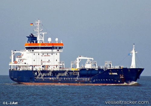
Vessel VERSUTIUS IMO: 9418925, MMSI: 253834000 Chemical/Oil Products Tanker
UTC, 51.22835, 1.74634, course: 208, speed: 12.6
UTC, 50.98756, 1.28998, course: 224, speed: 14.3
2026-03-03 07:48:40 UTC, 50.71500, 0.76833, course: -1, speed: 10
Live AIS position:
UTC. 11 nm SE of Saint Leonards-on-Sea),
updated 2026-03-03 07:48:40 UTC.
Find the position of the vessel VERSUTIUS on the map. The latter are known coordinates and path.
marine traffic ship tracker show on live map
The current position of vessel VERSUTIUS is 50.71500 lat / 0.76833 lng. Updated: 2026-03-03 07:48:40 UTCCurrently sailing under the flag of Luxembourg
VERSUTIUS built in 2008 year
Deadweight:
5757 tDetails:
Last coordinates of the vessel:
UTC, 51.49432, 2.00060, course: 221, speed: 10.4UTC, 51.22835, 1.74634, course: 208, speed: 12.6
UTC, 50.98756, 1.28998, course: 224, speed: 14.3
2026-03-03 07:48:40 UTC, 50.71500, 0.76833, course: -1, speed: 10