 vesseltracker.com
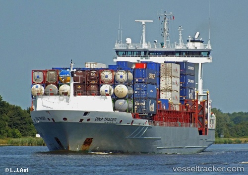
Vessel DINA TRADER IMO: 9354442, MMSI: 255801780 Container Ship
UTC, 54.92221, 7.48447, course: 0, speed: 12.3
UTC, 55.31321, 7.38796, course: 0, speed: 12
2026-02-04 10:39:56 UTC, 55.96778, 7.41892, course: 4, speed: 12.9
Live AIS position:
UTC. 24 nm W of HVIDE SANDE),
updated 2026-02-04 10:39:56 UTC.
Find the position of the vessel DINA TRADER on the map. The latter are known coordinates and path.
marine traffic ship tracker show on live map
The current position of vessel DINA TRADER is 55.96778 lat / 7.41892 lng. Updated: 2026-02-04 10:39:56 UTCCurrently sailing under the flag of Portugal (MAR)
DINA TRADER built in 2007 year
Deadweight:
11287 tDetails:
Last coordinates of the vessel:
UTC, 54.50511, 7.52584, course: 3, speed: 13.1UTC, 54.92221, 7.48447, course: 0, speed: 12.3
UTC, 55.31321, 7.38796, course: 0, speed: 12
2026-02-04 10:39:56 UTC, 55.96778, 7.41892, course: 4, speed: 12.9